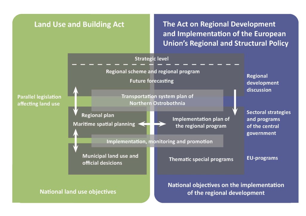
The Regional Land Use Plan is a general plan outlining the use of land in the region of Northern Ostrobothnia or parts of the region. The plan sets out the principles of land use and community structure and designates areas as necessary for regional development. The purpose of the plan is to settle national, regional and sub-regional land use issues. It is used as a guideline when drawing up and amending local master plans and local detailed plans in the municipalities, and when any other measures are taken to organise land use. The revision of the Regional Land Use Plan (2005) in three phases has been ongoing since 2010. When the revising in phases is finalized in 2018, there will be total four Regional Land Use Plans established by law in Northern Ostrobothnia, instead of eight.


